“Tbilisi re-development from 1980 to 2022” – an interactive map“Tbilisi re-development from 1980 to 2022” – an interactive map“Tbilisi re-development from 1980 to 2022” – an interactive map“Tbilisi re-development from 1980 to 2022” – an interactive map
  • Home
  • Research
  • Team
    • Ketevan Gurchiani
    • Ia Kupatadze
    • Tamta Khalvashi
    • Paul Manning
    • Giorgi Kankia
    • Jackson Freeman Mumper
  • Dissemination
    • Publications
    • Talks
    • Media
  • Events
  • Contacts

Tbilisi re-development from 1980 till 2022  
an interactive map

Project authors: Ia Kupatadze & Giorgi Kankia 

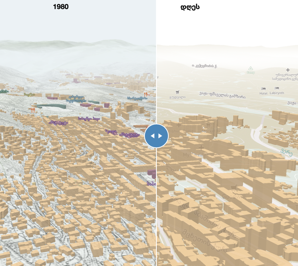
The map presents city development from 1980 till 2022, showing the densification, functional and height changes. 

The map was developed under the Shota Rustaveli National Science Foundation of Georgia grant Tbilisi as an Urban Assemblage  together with Ilia State University students. 

Resources and data was taken from:

1:2000 Scale Soviet Topographical Map
Tbilisi City Hall
National Archives of Georgia
National Agency of Public Registry of Ministry of Justice of Georgia

  • Home
  • Research
  • Team
  • Dissemination
  • Events
  • Contacts
  • Contact

  • (+995 32) 222 00 09
  • Info@Iliauni.Edu.Ge

SHOTA RUSTAVELI NATIONAL SCIENCE FOUNDATION OF GEORGIA